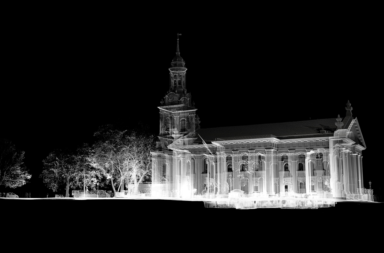
The results of the joint project, St Alfege Church in Translation, by Captivate Research Group in partnership with St Alfege, are on display at the university’s Stephen Lawrence Gallery.
Simon Withers, principal investigator of Captivate, says the exhibition is built upon around 400 3D scans and several thousand photographs, taken between 2017 and today.
He said: “St Alfege Church appears in this exhibition as familiar but somehow made strange.
“For instance the steeple, a vertical square stone assembly of seven temples ascending in diminishing scales, is now revealed as a stacking of beautiful domical chambers interconnected by wasp-waist airlocks. It looks almost like a 1731 speculative prototype of the International Space Station.
“The crypt, usually invisible, is now seen as a system of vaulted cells bearing the full weight of the visible church above. This system appears in the scans as if an organism, animated.
“The crypt itself does in fact slowly breathe, as becomes apparent when spending days down there scanning. Air, temperature and sound are stable towards the centre of the crypt system but fluctuate surprisingly towards the perimeter. Sounds from the world outside in particular can distort alarmingly, carried and amplified through what is essentially an unusually-crafted trumpet or baroque sonic instrument.”
Rebecca Parrant, Heritage Engagement & Interpretation Manager at St Alfege, added: “This partnership project has been building and developing steadily over the last few years and it is a delight to see the scans as part of a final exhibition.
“The diverse body of work highlights and reveals the beauty of our Hawksmoor church, which has been a key strand of our ‘Heart of Greenwich Place and People’ project funded by the National Lottery Heritage Fund.”
The purpose of the research project is to build models and records of the church by using what are known as “remote sensing technologies”.
Remote sensing is any technology that does not touch what it is recording, in this case the church.
Simon added: “Sketching and photography are types of remote sensing. We have also used Light Detection and Ranging (LiDAR) scanners, ground-penetrating radar and photogrammetry.
“The scanners use a rotating laser beam to record points in space. It goes out and, when it hits an object or surface, is reflected back to source. The time of flight is recorded and XYZ coordinates are determined for that specific point on an object.
“We perceive a wall as a surface but a LiDAR Scanner records a wall as millions of entirely separate points in space. This wall now exists in space as a cloud of points rather than a flat coherent surface, this data cloud is known as a point cloud.
“The main scanner we used gathers about a million points of data a second and the largest of the point cloud models of St Alfege comprises 8 billion points. It is about 250 gigabytes in size. Several scanners were used to make these models including, at lower resolution, iPhones and iPads.
“Everyone at St Alfege has been wonderful in giving us unrestricted access to scan since 2017, for which we are truly grateful. This project is one of several from the School of Design that St Alfege Church supports. We are also very grateful for support from the School of Design, the University of Greenwich, and from the Stephen Lawrence Gallery.”
St Alfege Church in Translation is available for all to see until Friday 14 May in the window display of the Stephen Lawrence Gallery, Stockwell Street, Greenwich, opposite St Alfege Church.
St Alfege Church in Translation, by Captivate Research Group in partnership with St Alfege Church ‘Heart of Greenwich Project’ funded by the National Lottery Heritage Fund is on display now.
University of Greenwich: Duncan Goodwin, Philip Hudson, Ed Wall, Simon Withers.
St Alfege Church: Rebecca Parrant, Wendy Foreman, David McEvoy, Jasmine Tonge.
Richard Griffith Architects, The Meridian Ringers
Instagram #captivategreenwich #stalfegechurch
Image: View of St Alfege Church from Stockwell Street

